Inside MINML-OS: The Software MINML Built for Itself
When the tools it needed did not exist, MINML wrote its own. A look inside the platform that now runs the company's exploration, from the licence map to the drill target.
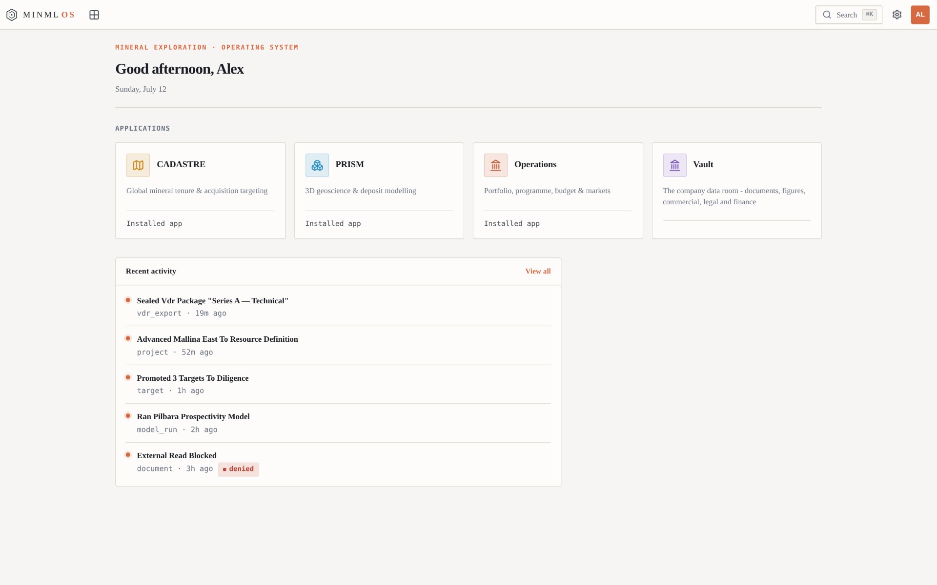
Ask most exploration companies what software they run on, and the honest answer is a drawer full of it: a mapping package here, a modelling suite there, and a lattice of spreadsheets holding the whole thing together. MINML runs on one system, and it built that system itself.
The company calls it MINML-OS. It is the platform its geologists and engineers open every morning, and it exists for an unglamorous reason. When the team went looking for a single place to move from a licence on a map to a target worth drilling, nothing on the market did the job end to end. So they wrote it.
MINML-OS is not a product. It is not for sale, and there are no plans to change that. It is proprietary infrastructure built to run one company's exploration, and what follows is a walk through what it does.
One console, four applications
The platform gathers four applications behind a single console, and all of them read from the same underlying records. A prospect flagged by the model, a boundary on the tenure map, a figure in the budget: each points at one shared object rather than a copy of it. Change something in one place and it changes everywhere, because there is only ever one version to change.
The four divide the work cleanly. Cadastre deals in ground and who owns it. Prism deals in rock, in three dimensions. Operations deals in the portfolio and the money. Vault, quieter than the others, governs the data the first three depend on.
MINML-OS is not a product. It is not for sale, and there are no plans to change that.
Cadastre: the ground and who holds it
Open Cadastre over a mineral belt and the official tenure streams in beneath the map as it moves. Licence boundaries, holders and expiry dates load into place, drawn straight from government registers. Where one jurisdiction publishes its cadastre, MINML-OS reads it; where a dozen publish theirs in a dozen formats, it reconciles them into a single view.
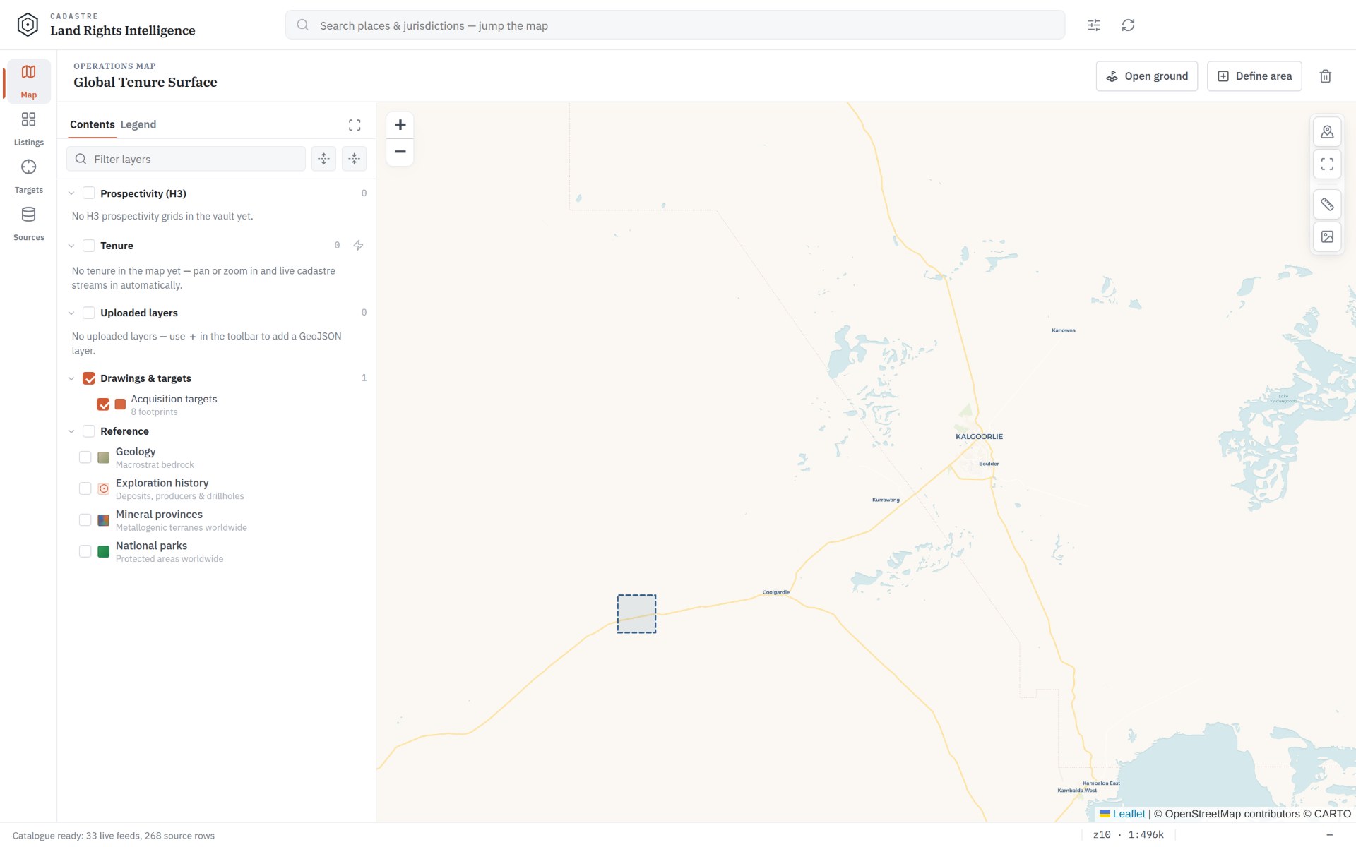
That matters because the first question in any new area is deceptively plain: who owns what, and what is still open. Answering it has traditionally meant trawling separate registers and stacks of scanned filings. Here it is a live layer. Open ground can be drawn, scored against the model, and pushed into an acquisition pipeline that ranks each parcel by prospectivity, size and jurisdiction.
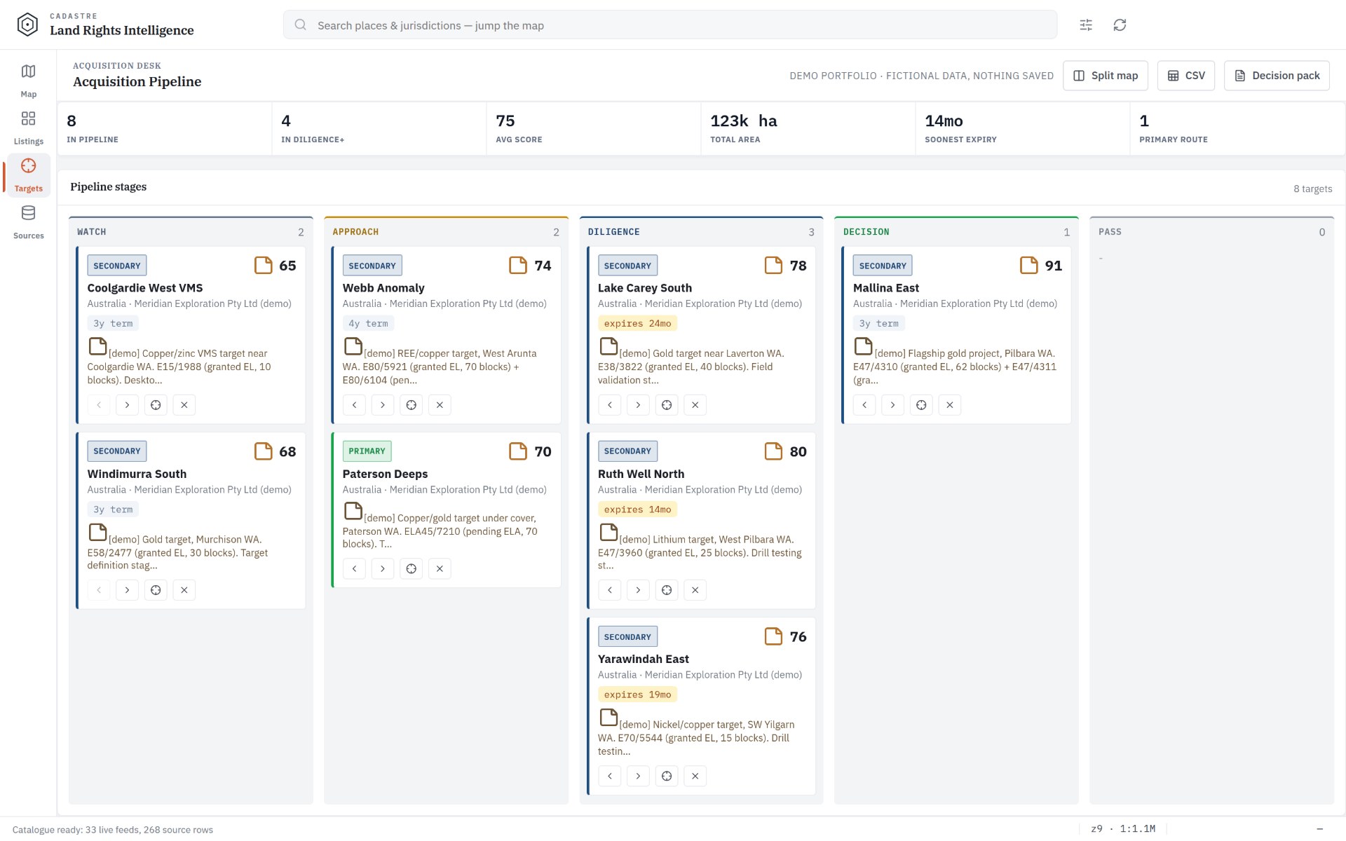
Prism: the orebody in three dimensions
If Cadastre is the map, Prism is the volume beneath it. It draws drillholes, grade logs and geophysics into a single three-dimensional scene, where prospectivity is rendered as isosurfaces and target shells rather than points on a plan.
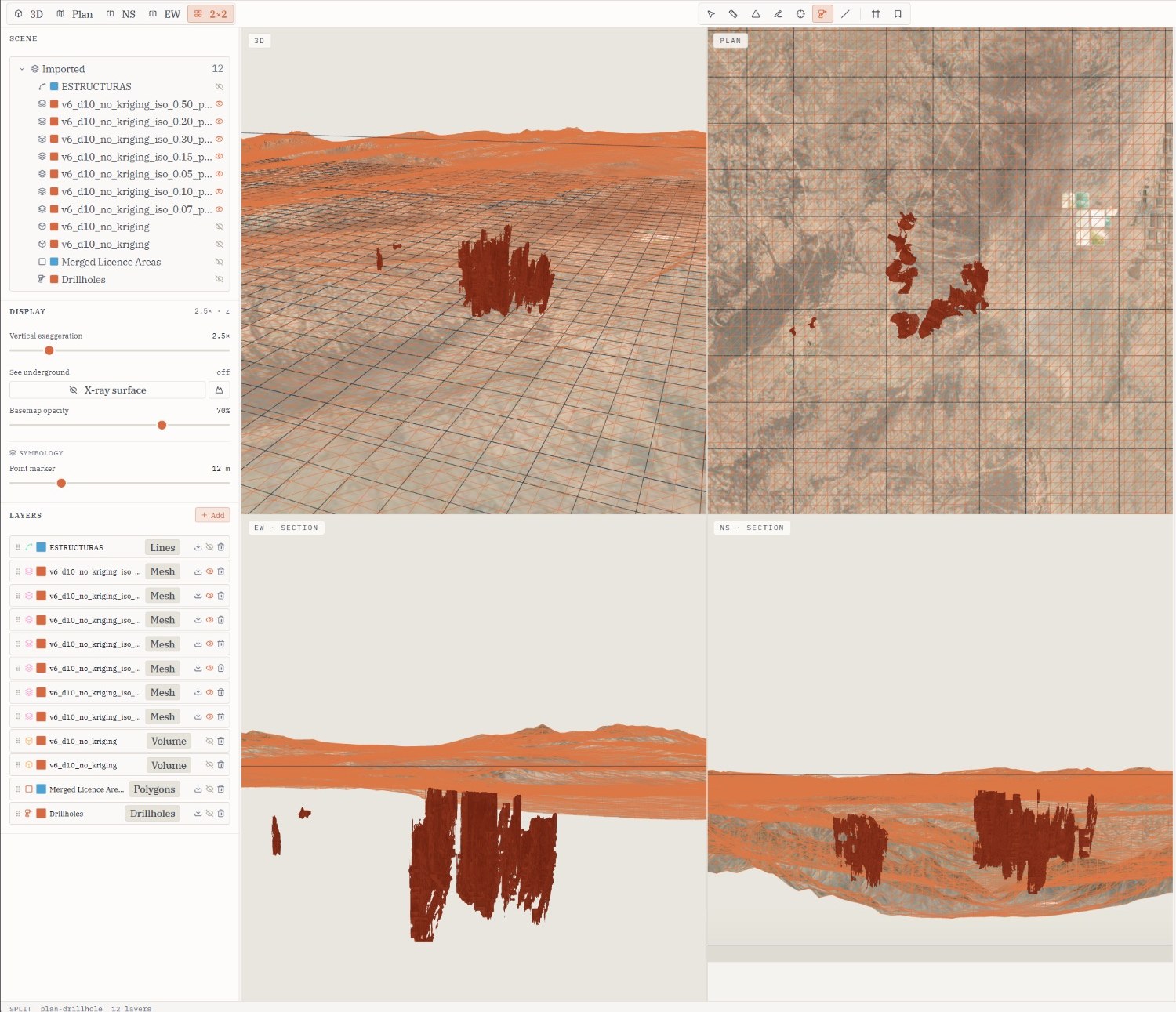
Move a threshold and the model re-meshes in front of you. Slice a section on any plane and the interior reads in true geological coordinates. This is the stage at which a ranked cell stops being a coloured dot and becomes a body with shape, depth and grade, something a geologist can push back on.
Operations: exploration as a portfolio
Exploration is usually described as a geological problem. It is at least as much a portfolio one, and Operations treats it that way. It sets indicative value against every asset, weighs a budget across the book by expected return and value at risk, and keeps an eye on the calendar so that a licence nearing a commitment deadline surfaces well before it lapses.
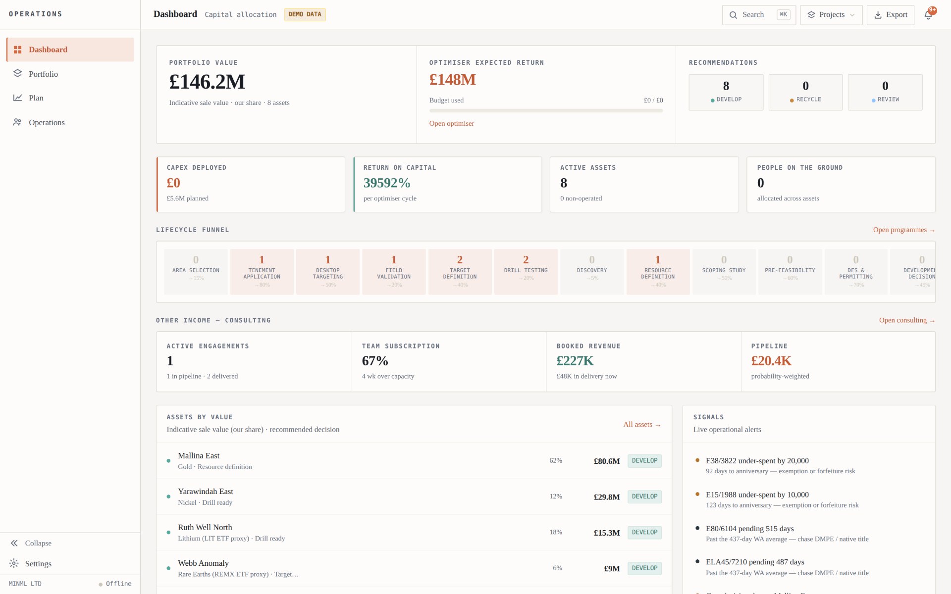
The effect is to put the geology and the capital on one screen. Choosing to spend on a target is visibly a choice not to spend on another, and the trade-off is there to be read rather than reconstructed after the fact.
Vault: the layer that keeps everyone honest
Beneath the maps and models sits Vault, the platform's governed data room, and it is the part the company is most careful about. Every record that feeds a decision is stored, permissioned and versioned there.
Internal, partner and investor sessions each see their own scoped view. External users are shown a demonstration portfolio and never the live ground. Every promotion, export and access request is logged, and a read that should not happen is refused and recorded. The audit trail, in other words, exists by default rather than by good intentions.
Why it exists
The argument for building all of this in-house comes down to coherence. Because the model, the map and the plan draw on one set of records, they cannot quietly drift apart, and each project the company runs leaves the tools a little sharper for the next. MINML-OS is the machinery behind that compounding: one place to carry a search from open ground to a ranked, fundable portfolio.
The screens shown here are genuine output from the applications, run over a fictional demonstration portfolio on top of live public tenure and terrain. MINML is an exploration business first. MINML-OS is simply how the work gets done.
If you run an exploration team or generate your own projects, and you want to understand how the company operates, its founders would be glad to talk.